
The 3 Best Ways to Use Outline Maps of World History
Hardcover available for just $10 more!
Free Curriculum Integration Guides
You will not see this offer again, so if you are interested, you MUST act now.
Try them yourself to see if Map Trek maps are not the best historical
outline maps of the world available anywhere today.
 |
Now you can have hundreds of historical outline maps at your finger tips. Save yourself countless hours scouring the internet for the perfect printable map for your history lesson! Recommended by The Well-Trained Mind!
Grade Level: 1-12 grades
Page Count: 350 World + 235 American
"I got mine today! I love them! I love the convenience! My son loves them! Why didn't I order these earlier instead of spending hours scouring the internet for maps that didn't quite work?" - Sharon
Did you know?
It is a proven fact that using historical outline maps help cement historical and geographical facts for students and adults alike. Just knowing that Alexander the Great conquered the whole known world is simply not enough. Seeing this enormous ancient empire on paper gives visual and non-visual students an edge in their learning.
The truth is... most educators know this, but struggle to find the printable maps they are looking for. Now your search is over. Finally, Map Trek Historical Atlas and Outline Maps is now available as a set of six (6) beautiful full-color e-books for easy printing.
With Map Trek Historical Atlas and Outline Maps, you, as the teacher, can...
- Have over 465 World History Maps at your fingertips.
- Print them all or just the ones you need today.
- Print multiple copies for your family's use. (Schools, classrooms and co-ops can take advantage of our volume discounts or site license agreement.)
- Never worry about lesson plans for your historical outline maps. We've included them for you!
- Have different aged students working at their own ability. No more trying to stretch the lesson up or down.
With Map Trek Historical Atlas and Outline Maps, your students can...
- See the landscape (i.e. the political boundaries, major cities, etc.) from the historical time period - instead of what the region is like today.
- Label places of historical significance on their outline maps.
- Color in empires, trace travel routes, draw scales and directional symbols, etc.
- Maps don't have to be boring... Students should feel free to experiment with colored markers, pencils, paint and even glitter (this is optional, of course!)
- Finished maps can be posted to the bulletin board or refrigerator or placed in a history notebook.
You may be wondering if you can find most of these printable maps for free online? The truth is, quite frankly, that you will not. I used to spend countless hours scouring the Internet for the appropriate map for our history lesson. Sometimes BINGO I would find just what I was looking for. But more often than not, there would be something about the map that I wished I could change. Maybe we were studying the United Kingdoms of Italy and the boundaries of the territories were not there. Or maybe we were studying South America during the times of the Spanish conquistadors and the only maps I could find had current political boundaries or no boundaries at all.
I began producing these printable maps in 2001 for Susan Wise Bauer's Story of the World series. Since then, we have greatly improved the quality of the maps using vector graphics and full color. These new upgraded computer generated maps are cleaner, clearer and easier to use than the original ones.
Imagine... You will no longer have to search for the perfect map online. You will have it right on your computer! Here is everything that you will get when you purchase Map Trek: The Complete Collection:
Map Trek: Ancient World
- World Map with landforms
- The Descendants of Noah
- Mesopotamia
- Sumerians
- Call Out of Ur
- Abraham's Journey
- Ancient Africa
- Old Kingdom of Egypt
- Ancient Egypt
- The Exodus
- The Promised Land
- Twelve Tribes of Israel
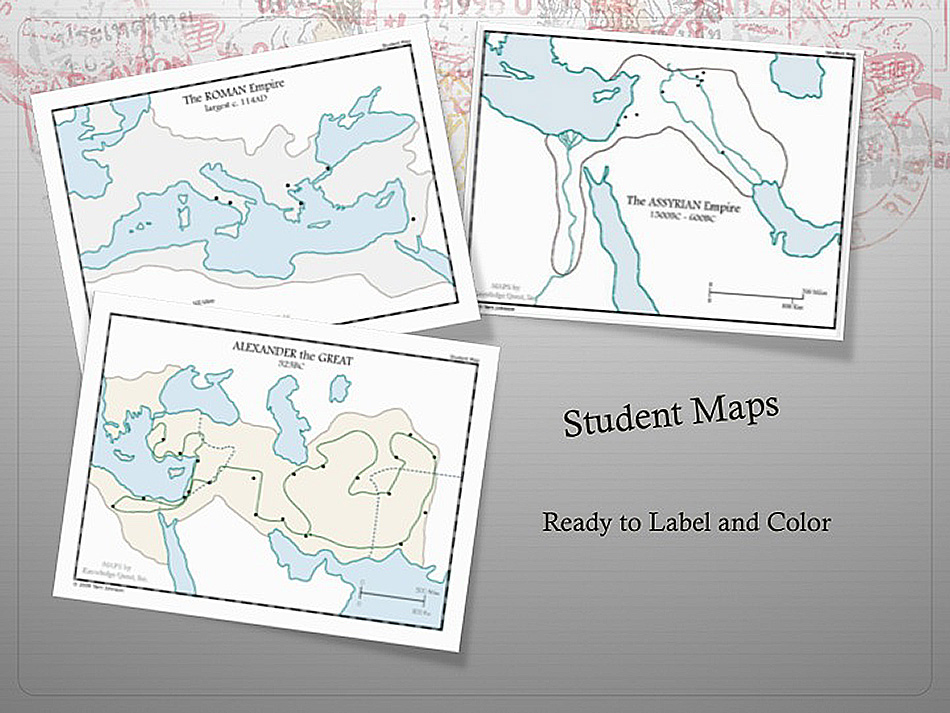
- The Assyrian Empire
- Israel's Golden Age
- Phoenicia's Trading Empire
- Solomon's Kingdom
- Israel's Divided Kingdom
- Ancient India
- Ancient China
- The Founding of Rome
- Babylonian Empire
- The Persian Empire
- Greco-Persian Wars
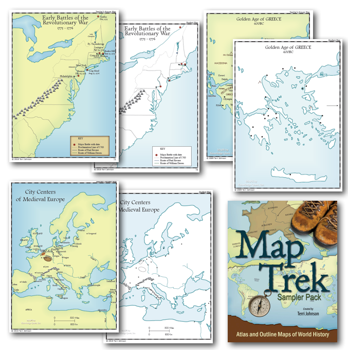
- Golden Age of Greece
- Ancient Europe
- Alexander the Great
- The Punic Wars
- Ancient Palestine
- The Early Church
- The Roman Empire
- The Roman Empire Divided
- Barbarian Invasions
- World Map (with grid)
- Egypt Map (with grid)
- Israel Map (with grid)
- Greece Map (with grid)
- Roman Empire Map (with grid)
- Two blank grids (different sizes)
“I just wanted to say THANK YOU for the Map Trek book. I LOVE it! It is beautiful!!!!! I cannot wait to use it this year with our history. I have never seen anything like it--YOU ARE AMAZING! Out of all the new books I bought this year, this is the one I am MOST excited about! Thank you, thank you, thank you!!!!!!” - Anna
Map Trek: Medieval World
- World Map with landforms
- Byzantine Empire
- Islamic Empire
- Viking Expansion
- Empire of Charlemagne
- The Holy Roman Empire
- African Kingdoms
- Norman Conquests
- The Crusades
- Mongol Empire
- Medieval China
- City Centers of Europe
- Medieval Japan
- 12th Century Europe
- The Black Death
- Hundred Years' War
- Renaissance Italy
- Early Explorers
- Christopher Columbus
- Later Explorers
- Central and South America
- The Powerful Habsburgs
- The Netherlands
- The Reformation
- The Expansion of Sweden
- The Expansion of Russia
- Spanish and Portuguese Empires
- World Map (with grid)
- Europe Map (with grid)
- Italy Map (with grid)
- England Map (with grid)
- South America Map (with grid)
"Can I just say thank you so much for the wonderful resources you have available on your website? Well written, beautifully designed, incredibly useful and all of this available in downloadable formats!” - Shannon
Map Trek: New World
- World Map with landforms
- Elizabethan London
- James Towne
- African Exploitation
- Renaissance Italy
- North America (map 1)
- North America (map 2)
- Native American Tribal Groups
- Plymouth Colony
- Thirty Years' War
- Australia Discovered
- King Philip's War
- Ming/Qing Dynasties of China
- The Mughal Empire
- The Original 13 Colonies
- The Iroquois League
- Puritan England
- Restoration Colonies
- Prussia
- New England Colonies
- The Middle Colonies
- The Southern Colonies
- The Seven Years' War
- The Explorations of Daniel Boone
- Early Battles of the Revolutionary War
- The American Revolution
- Russia
- The French Revolution
- Napoleonic Wars
- Lewis and Clark Expedition
- Independence for Latin America
- Composers
- Inventors
- England - Industrial Revolution
- War of 1812
- Growth of the USA (map 1)
- Australia
- Growth of the USA (map 2)
- U.S. Trails of Expansion
- Goldrush in California
- Westward Expansion
- Mexican War
- The Pony Express
- Telegraph Lines
- European Revolutions of 1848
"I just wanted to drop you a line and let you know how WONDERFUL your maps are! I just love to use maps in school; it makes everything so clear. And your maps are perfect for each unit we study. It's great to have a resource like this instead of having to paw through numerous books to find maps and then have to shrink them or enlarge them to suit the need! I have recommended your maps to many people." - Sue
Map Trek: Modern World
- World Map with landforms
- Current Political World Map
- The Crimean War
- Japan Opens to Trade
- Leading Up to the Civil War
- The American Civil War (map 1)
- The American Civil War (map 2)
- The Battle of Gettysburg
- The Battle of Vicksburg
- Italy United
- Reconstruction
- The Battle of Little Bighorn
- The Dominion of Canada
- Africa with landforms
- India Under Rule of British Easy India Co.
- The British Empire
- The Boxer Rebellion in China
- The Scramble for Africa
- South Africa /Boer War
- Jim Crow Laws in USA
- Right to Vote in USA
- US Major Centers of Immigration
- World Empires 1900
- The Balkan Wars
- World War I (map 1)
- World War I (map 2)
- The Russian Revolution
- The Division of Ireland
- Europe, Post WWI
- Iberian Peninsula
- Famous Early Flights
- The Great Depression
- Totalitarianism
- China and Japan at War
- The Baltic States
- World War II (map 1 - European Theater)
- The Bombing of Pearl Harbor
- World War II (map 2 - Pacific Theater)
- Italy and the Balkan Peninsula
- The Growth of Communism
- Independence for India
- The Middle East
- The Nation of Israel
- The Cold War
- The Korean War
- The Vietnam War
- The Wars in Asia
- Indonesia
- New Zealand
- Cuba
- The Gulf War
- 9/11 - Attack on the U.S.
- Afghanistan
- Conflict in Iraq
- 50 State Maps
Two of each map topic is included - one for the teacher and one for the student. Print as many maps as you need for your family with this set (group licenses available). Also included are complete lesson plans for students in grades 1-12.


End the search for maps on the Internet for good.
Now you can have every world and U.S. maps that you need right at your fingertips. You'll get access to all of these maps just minutes after you click the "Add to Cart" button.
30 Day Money-Back Guarantee: I'm so confident that Map Trek is the map solution that you are looking for, that if you do not LOVE the ease and convenience of Map Trek within the first month of using it, just send me an email and I'll refund the full purchase price back to you... no questions and no hassles.
You've wasted enough of your time and energy trying to find the most useful maps online.
The GOOD NEWS is that you have finally found them.
Think about it... The next time you need a map to show where an even in history took place or for a mapping activity, you can just pull out your Map Trek book, click print and you are ready to go.
Grab your copy of Map Trek at this ONE TIME ONLY price by clicking the "Add to Cart" button now and you'll be trekking with your students throughout history starting today.
Hardcover available for just $10 more!

