
Map Trek: U.S. Edition
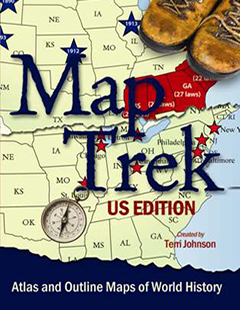
Atlas and Outline Maps of U.S. History
ISBN: 978-1-932786-32-3
Grade Level: 1-12 grades
Page Count: 242 ebook or CD-ROM
Price: $19.95

Have you ever been teaching a history lesson when one of your children pipes up with a question... "Mom, is Texas a state or its own country?" You smile to yourself and are tempted to answer, "Yes, Texas is a state, but they would sure rather be their own country!" But you hold your tongue and decide that it's time to review U.S. geography. Then you wonder if you can combine this study with your current U.S. history studies...
The answer is, "Yes, you can!"
Map Trek: U.S. Edition is an atlas plus historical outline maps that allow you to teach geography alongside history. This is a resource that any homeschool parent can use with brilliant success, even if you don't remember a thing from your history or geography classes in public school.
Grab your children by the hand. It's time to explore our world throughout history. Let's take a map trek! This CD-ROM contains 53 historical maps, 50 state maps, 3 U.S. maps in different sizes, and 106 student maps.
We have heard your comments throughout the years and have set out to provide THE most attractive and highly useful map book for home educators. You have said that you want...- Historical maps that will help you navigate through history studies.
- Accurate maps that show what the world was like THEN and NOW.
- Maps that are easily downloadable yet inexpensive to print.
- Attractive maps that you and your children will be proud to display.
- Lesson plans that will show you what to do with them each week.
Map Trek meets all five of these demands and more. Here's what the new Map Trek will provide you:
1. A full color teacher's answer map that will help you tremendously.
2. An unlabeled student map for your child to color in and label. There is a slight color shading on the ocean/water areas to help your child determine which parts of the map are land and which are water. BUT the shading is minimal so as to not interfere with his creative coloring process OR to use much ink when printing from your printer.
3. Lesson Plans to help you know what to assign to each of your children at their various stages of learning. There are lesson plans included for all 50+ outline maps and are broken down into 3 levels - Level A (grades 1-4), Level B (grades 5-8) and Level C (grades 9-12).
So, this is what you get by the numbers...
- 106 Full-color teacher answer maps.
- 106 Blank outline maps for the student.
- Instructions for how to use these maps
- 53 Historical maps
- 50 State maps
- Lesson Plans
- 3 Full US maps (different sizes)
- 242 total pages
- $19.95 ebook or CD-ROM
Since these maps are chronological in sequence, you may use them easily with any chronological history program. These maps are meant to enhance your current history program and make it even better.
To view the full Table of Contents, please download the Map Trek Sampler at the link below for complete map listing.
This CD-ROM is PC and Mac compatible.
Would you prefer the ebook so that you can get it today AND save on shipping costs?
Get the Map Trek: US Edition ebook today -
$19.95
Buy both CD-ROMs - World and U.S. - and Save!
$49.95 for both
Don't forget to grab your FREE Curriculum Integration Guides!
Would you like to download the Map Trek Sampler Pack for free? It is loaded with 32 maps with lesson plans that you can begin using today. Get your free 47 page Sampler Pack here - http://www.knowledgequestmaps.com/Try-MapTrek.html.
Looking for Ancient World Map Trek ebook? Click here.
Looking for Medieval World Map Trek ebook? Click here.
Looking for New World Map Trek ebook? Click here.
Looking for Modern World Map Trek ebook? Click here.
Looking for the Map Trek: Complete Collection CD? Click here.
